项目实践 Project
机器视觉与模式识别 Machine Vision & Pattern Recognition
-
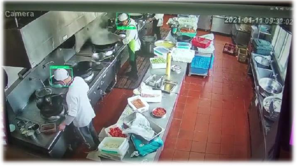
明厨亮灶 AI 监控解决方案AI Monitoring for Smart Kitchen Safety
技术负责 · Technical Lead
负责后厨视觉安全算法研发,完成数据分析、清洗与图像处理;基于 YOLOv5 开发并优化口罩、厨帽和工作服识别算法,结合吸烟、打电话等行为检测、卫生识别与烟雾报警。针对后厨雾气导致的误报优化识别与预警逻辑。系统上线百度 AI 市场,并部署于杭州高速服务站后厨。
Led kitchen-safety algorithm development, including data preparation and the development and optimization of YOLOv5-based algorithms for detecting masks, kitchen hats, and workwear. The solution also covers smoking and phone-use detection, hygiene monitoring, and smoke alarms. Added haze recognition and refined alert logic to reduce false alarms. The system was listed on Baidu AI Market and deployed in kitchens at Hangzhou highway service stations.
-
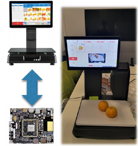
生鲜识别算法与智能电子秤Fresh Produce Recognition & Intelligent Scales
项目负责 · Project Lead
带领团队,与国隆电子合作研发智能生鲜识别秤。结合购物行为轨迹约束与在线检索处理套袋商品识别,融合离线与在线学习,支持新品类增量更新、自动标注和在线训练。方案上线百度 AI 市场,形成国内及比利时的量产规划。
Led a team with Guolong Electronics to develop intelligent produce-recognition scales. Combined shopper-trajectory constraints and online retrieval for bagged produce, with offline and online learning, incremental category updates, automatic annotation, and online training. The solution was listed on Baidu AI Market; production plans were developed for China and Belgium.
-

艺术品与珠宝细粒度识别Fine-Grained Art & Jewelry Recognition
项目负责 · Project Lead
负责面向华夏收藏网的艺术品与珠宝分类识别项目,针对颜色和样式差异较小的商品进行细粒度区分,结合模型部署与在线学习,支持后续类别扩展和识别模型更新。
Led an art and jewelry recognition project for Huaxia Collection, distinguishing categories with subtle differences in color and style. The solution combines model deployment and online learning to support category expansion and model updates.
-
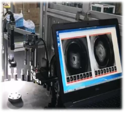
笔帽工件缺陷检测Visual Defect Inspection for Pen Caps
项目负责 · Project Lead
独立研发结合红外图像分割与半监督生成对抗学习的笔帽工件缺陷检测方法,在得力文具生产线实测达千分之三误报率,为流水线质检提供自动化视觉辅助。该视觉方案后续由雷达方案替代。
Independently developed a pen-cap defect inspection method combining infrared image segmentation with semi-supervised generative adversarial learning, achieving a false-positive rate of 0.3% in tests on a Deli stationery production line. The visual solution was later replaced by a radar-based approach.
-

火成岩细粒度识别Fine-Grained Igneous Rock Recognition
项目负责 · Project Lead
负责面向地质勘探的火成岩智能分类项目,通过细粒度特征融合与区分识别相近岩石类别,并支持新增类别的增量学习,辅助岩石样本识别与分类。
Led an igneous rock classification project for geological exploration. The approach combines fine-grained feature fusion and discrimination with incremental learning to recognize similar rock types and accommodate new categories.
-
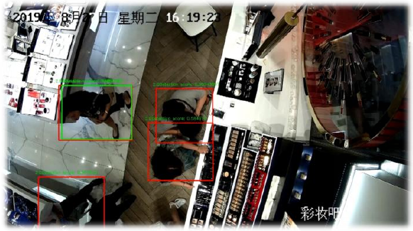
零售门店智能视觉Intelligent Vision for Retail Stores
项目参与 · Project Contributor
参与化妆品门店智能视觉项目,场景包括雅诗兰黛门店,覆盖顾客计数、状态识别、意图预测、用户推荐与防盗预警,为门店运营和安全管理提供视觉分析支持。
Contributed to visual analytics for cosmetics stores, including an Estée Lauder store case. The solution covers customer counting, state recognition, intent prediction, recommendations, and theft alerts for store operations and security.
-
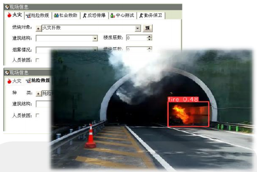
消防预警与应急辅助Fire Warning & Emergency Response Support
项目参与 · Project Contributor
参与杭州消防预警场景的视觉应用项目,涵盖火焰检测、失火报警与态势分析,并结合智能调度和路径规划,为应急响应提供辅助信息。
Contributed to a fire-warning application in Hangzhou, covering flame detection, fire alarms, and situation analysis, with dispatch and route-planning functions to support emergency response.
-
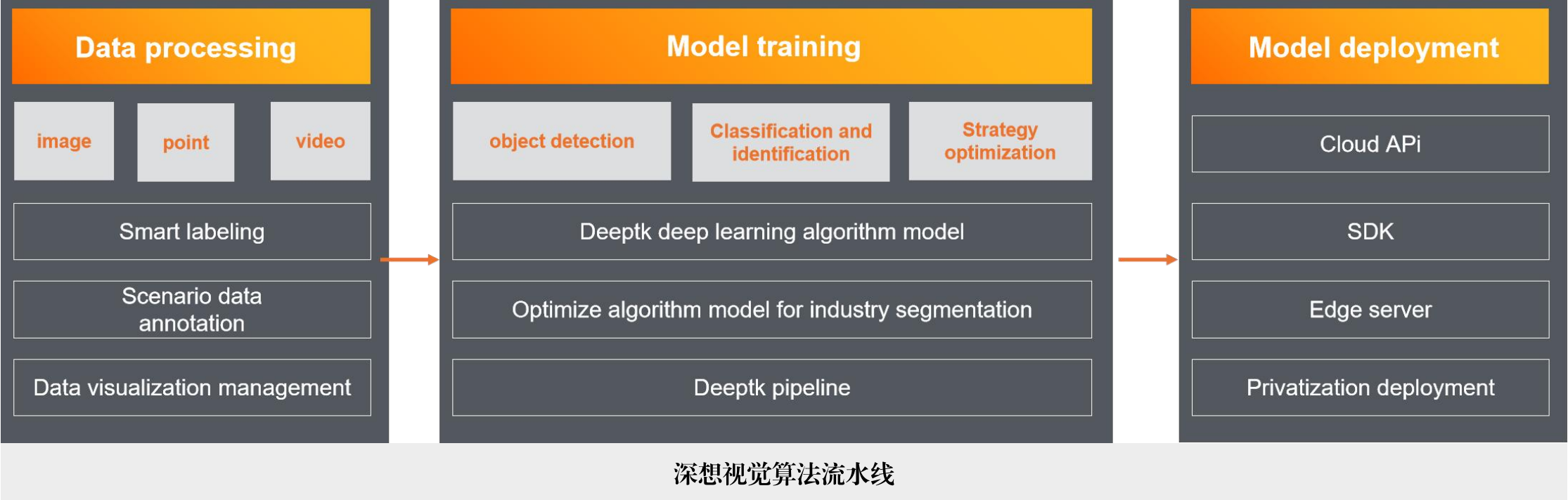
视觉算法训练与部署流水线Visual Model Training & Deployment Pipeline
项目负责 · Project Lead
负责行业视觉算法流水线建设,串联数据标注、模型训练、模型转换与部署流程,覆盖检测、分割、检索和分类任务,支持 Cloud API、SDK 与边缘服务器等交付方式。后续在工厂叉车识别与自动化管理等项目中进行落地应用验证。
Led development of a vision pipeline connecting data annotation, model training, conversion, and deployment. It supports detection, segmentation, retrieval, and classification through Cloud APIs, SDKs, and edge servers. The pipeline was subsequently validated in practical projects including factory forklift recognition and automated management.
自动驾驶与智慧交通 Autonomous Driving & Intelligent Transportation
-

T03 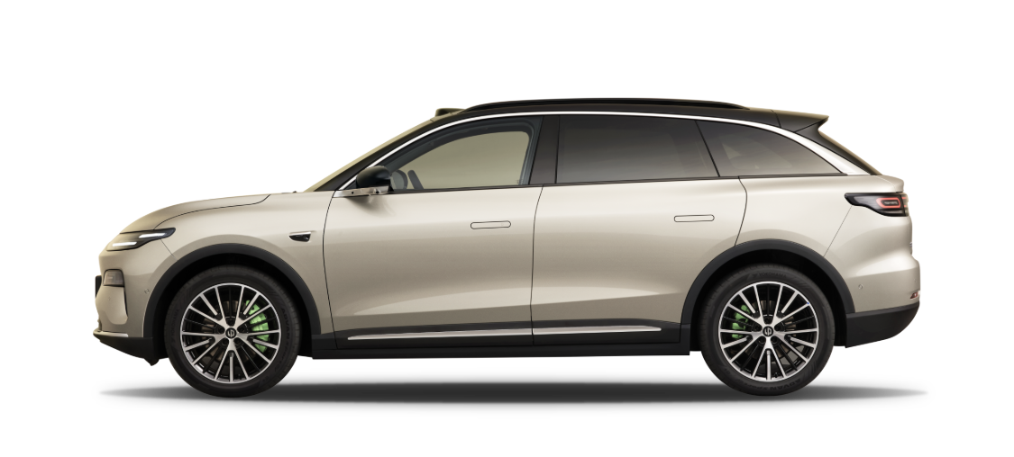
C11 零跑 T03/C11 NOA 感知算法与自动化标注系统Leapmotor T03/C11 NOA Perception & Automated Annotation System



2021–2022 · 项目研发 · Project R&D
开发多任务视觉训练框架并对接公司集群平台,预研结合变分自编码器与自监督优化的细粒度车型分类。参与 T03/C11 NOA 交通信号、交通标志与地面标识检测识别,模型迭代两版后上车部署,投入应用并持续 OTA 升级。融合视频检测跟踪、伪标注生成与自动评测,约半年完成公司首版视觉算法自动化评测与数据标注系统,覆盖二维检测、关键点、朝向和实例分割任务,自动化标注与评测准确率>95%。
Developed a multi-task vision training framework integrated with the company’s cluster platform, and explored fine-grained vehicle classification using variational autoencoders and self-supervised optimization. Developed traffic-light, traffic-sign, and road-marking recognition for T03/C11 NOA, with on-vehicle deployment after two iterations, followed by operational use and ongoing OTA upgrades. Combined video detection and tracking, pseudo-label generation, and automated evaluation to build the company’s first evaluation and annotation system in about six months, supporting 2D detection, keypoints, orientation, and instance segmentation, with automated annotation and evaluation accuracy >95%.
-
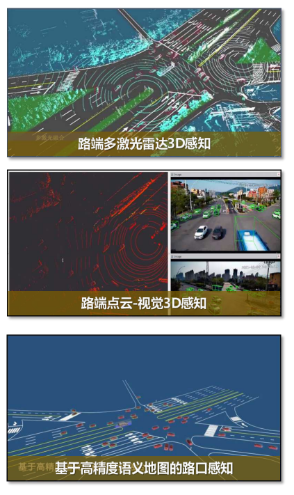
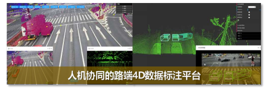
车路协同路侧智能感知系统Roadside Intelligent Perception System for Vehicle–Infrastructure Cooperation




西安交通大学—大唐移动网联协同智能实验室;西安交通大学—中国移动联合研究院Xi'an Jiaotong University–Datang Mobile Joint Laboratory for Connected Collaborative Intelligence; Xi'an Jiaotong University–China Mobile Joint Research Institute
2022–2025 · 项目负责(学生) · Student Project Lead
协助联合实验室项目管理与方案设计,参与大唐移动、中国移动共建项目,组织学生联合研发与优化 YOLOX 路侧二维感知、视觉与 BEV 表征结合的三维感知、多激光雷达检测跟踪融合,以及 LiDAR、Camera、GNSS、Radar 的人机协同半自动联合标定。设计基于地面约束的单目三维检测与跟踪方法(50m 范围内平均定位误差<30cm)。项目阶段内,二维感知与融合系统已在北京亦庄和杭州应用,标定已投入使用,路侧三维感知开展现场部署测试,时空一致性 4D 标注平台推进工程开发。支撑中国移动、大唐移动等行业头部企业,在厦门 BRT 快速公交、杭州萧山智慧路网、无锡市车路云一体化、蔚来汽车自动下线系统等项目中落地应用。
Supported joint-lab management and system design for projects with Datang Mobile and China Mobile, coordinating student development and optimization of YOLOX roadside 2D perception, vision–BEV 3D perception, multi-LiDAR detection and tracking fusion, and human-assisted semi-automated LiDAR/camera/GNSS/radar calibration. Designed ground-constrained monocular 3D detection and tracking with an average localization error of less than 30cm within 50m. During this phase, 2D perception and fusion systems were deployed in Beijing E-Town and Hangzhou, calibration was in use, roadside 3D perception underwent field testing, and the spatiotemporally aligned 4D annotation platform was under development. Supported industry leaders including China Mobile and Datang Mobile in deploying solutions for Xiamen BRT, the Xiaoshan smart road network in Hangzhou, Wuxi’s vehicle–road–cloud integration program, and NIO’s automated vehicle roll-off system.
-
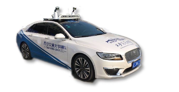
先锋号 
勇士号 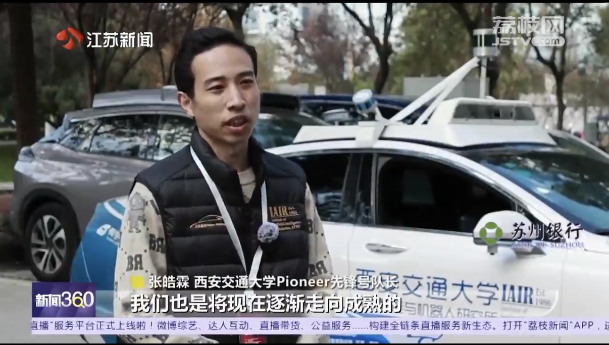
赛事采访 · Competition interview [Video] 中国智能车未来挑战赛China Intelligent Vehicle Future Challenge
2023、2024、2025 · 三届 / Three editions
待补充
To be added
-
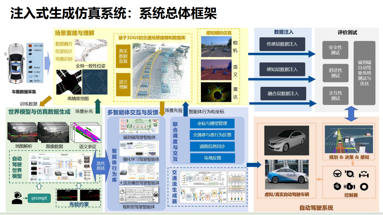
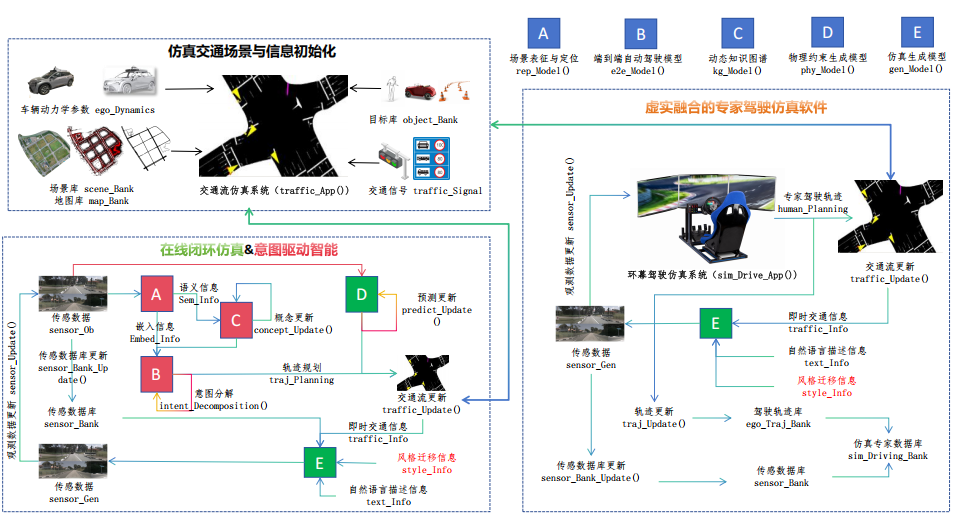
注入生成式自动驾驶仿真系统Injection-Based Generative Autonomous Driving Simulation System
项目负责(学生) · Student Project Lead
负责注入式生成仿真与意图驱动自动驾驶研究,融合真实道路数据、高精地图、3DGS 场景重建、交通流控制与世界模型,探索可控交通场景及多模态传感数据生成。围绕传感器、感知与融合层数据注入,结合语义锚定、动态知识图谱、意图建模和价值对齐,研究场景生成、驾驶交互与评价反馈的闭环机制,并引入多智能体交互及专家驾驶的“人在回路”验证,为复杂交通环境下的自动驾驶训练与安全性、舒适性、交互性评估提供支撑。
Lead research on injection-based generative simulation and intent-driven autonomous driving, combining real-road data, HD maps, 3DGS scene reconstruction, traffic-flow control, and world models for controllable scene and multimodal sensor-data generation. Investigate sensor-, perception-, and fusion-level data injection alongside semantic anchoring, dynamic knowledge graphs, intention modeling, and value alignment. Explore a closed loop of scene generation, driving interaction, and evaluation feedback, incorporating multi-agent interaction and expert-driven human-in-the-loop validation to support autonomous-driving training and assessment of safety, comfort, and interaction in complex traffic environments.
eVTOL与低空经济 eVTOL & Low-Altitude Economy
-

基于世界模型的eVTOL飞行推演与分析软件World-Model-Based eVTOL Flight Simulation and Analysis Software
项目负责(学生) · Student Project Lead
负责面向低空飞行的世界模型软件研发,融合静态、动态仿真与真实飞行数据,构建超过100万帧数据集,完成轨迹、前视图像与深度信息的筛选、标注和管理。结合场景深度估计与时序多模态建模,根据历史观测和飞行动作推演未来场景,支持百米级场景生成,以4–6 Hz输出832×480图像。集成路径渲染与编辑、推演结果对比和数据存储,为eVTOL数字孪生与仿真测试提供支撑,并通过不同候选路径的未来场景推演辅助导航与路径规划,减少对稀缺实飞数据的依赖和实飞试错成本。
Led development of world-model software for low-altitude flight, combining static and dynamic simulation with real-flight data to build a dataset of over one million frames, with filtering, annotation, and management of trajectories, forward-view images, and depth information. The system combines depth estimation and temporal multimodal modeling to predict future scenes from historical observations and flight actions, supporting scene generation over hundred-meter distances at 832×480 resolution and 4–6 Hz. Integrated path rendering and editing, comparison of predicted results, and data storage to support eVTOL digital twins and simulation testing. By predicting future scenes along candidate routes, the software supports navigation and path-planning analysis while reducing reliance on scarce real-flight data and the cost of physical trial and error.
-
eVTOL-智能感知规划系统eVTOL Intelligent Perception and Planning System
感知模块负责人(学生) · Student Perception Module Lead
面向精准降落引导,设计可定制的复合结构化标志物,将全局特征检测与局部特征相对位姿估计结合,融合误差模型与加权处理,并完成像素、相机和降落坐标系转换。降低对固定标志样式与尺寸的依赖,为动态场景下的降落引导提供实时相对位姿信息。
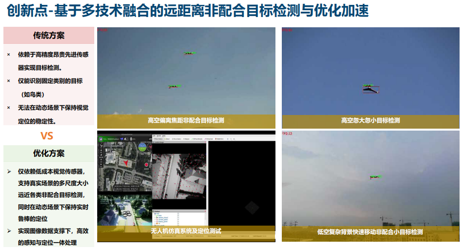
面向非配合目标检测与避障规划,基于低成本视觉传感器开展多尺度目标检测、视觉定位与算法优化加速,覆盖高空小目标、低空复杂背景及快速运动目标等场景。结合无人机仿真与定位测试,推进图像数据驱动的感知与定位一体化,为避障规划提供目标感知与定位信息。
Developed customizable composite landing markers for precision landing guidance, combining global-feature detection with local-feature relative pose estimation, error modeling, and weighted fusion. Transformations between pixel, camera, and landing coordinate systems provide real-time relative pose information, reducing dependence on fixed marker designs and dimensions in dynamic scenarios.
Developed multi-scale non-cooperative target detection, visual localization, and algorithm acceleration using low-cost visual sensors, addressing small airborne targets, complex low-altitude backgrounds, and fast-moving objects. Combined UAV simulation and localization testing to advance image-based perception and localization, providing target and position information to support obstacle-avoidance planning.
-
机载疲劳监测与大模型语音指令系统Onboard Fatigue Monitoring and Large-Model Voice Command System
项目负责(学生) · Student Project Lead
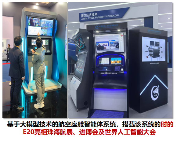
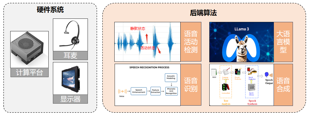
负责融合视觉疲劳监测与离线大模型语音交互的机载座舱系统,在时的科技地面原理样机上首次实现离线大模型应用。语音链路集成语音活动检测、识别、语义理解与语音合成,唤醒响应≤500 ms、交互响应≤1 s,低噪环境下精确指令与模糊指令识别准确率分别≥95%和≥80%。支持语音唤醒、操作验证、界面打开等控制指令,并依据大模型语义理解返回响应码或指定输出。视觉监测实现人脸检测准确率>95%、人脸关键点检测准确率>85%,支持闭眼、低头、打哈欠与分心驾驶预警,以及镜头遮挡、驾驶座无人预警。系统作为主要技术展示点亮相2025年中国国际进口博览会,并在珠海航展展示。
Led development of an onboard cockpit system combining visual fatigue monitoring with offline LLM voice interaction, enabling the first offline LLM application on TCab Tech’s ground-based proof-of-concept prototype. The voice pipeline integrates activity detection, speech recognition, semantic understanding, and speech synthesis, with wake-up response ≤500 ms and interaction response ≤1 s. In low-noise conditions, recognition accuracy reaches ≥95% for exact commands and ≥80% for ambiguous commands. It supports wake-up, operation verification, interface opening, and other control commands, using LLM semantic understanding to return response codes or specified outputs. Visual monitoring achieves face detection accuracy >95% and facial landmark detection accuracy >85%, providing alerts for closed eyes, head-down posture, yawning, distraction, camera occlusion, and an unoccupied seat. The system was a key technology demonstration at the 2025 China International Import Expo and was also showcased at the Zhuhai Airshow.
-
eVTOL-DAA智能感知与避障系统eVTOL Detect and Avoid (DAA) System
项目负责(学生) · Student Project Lead
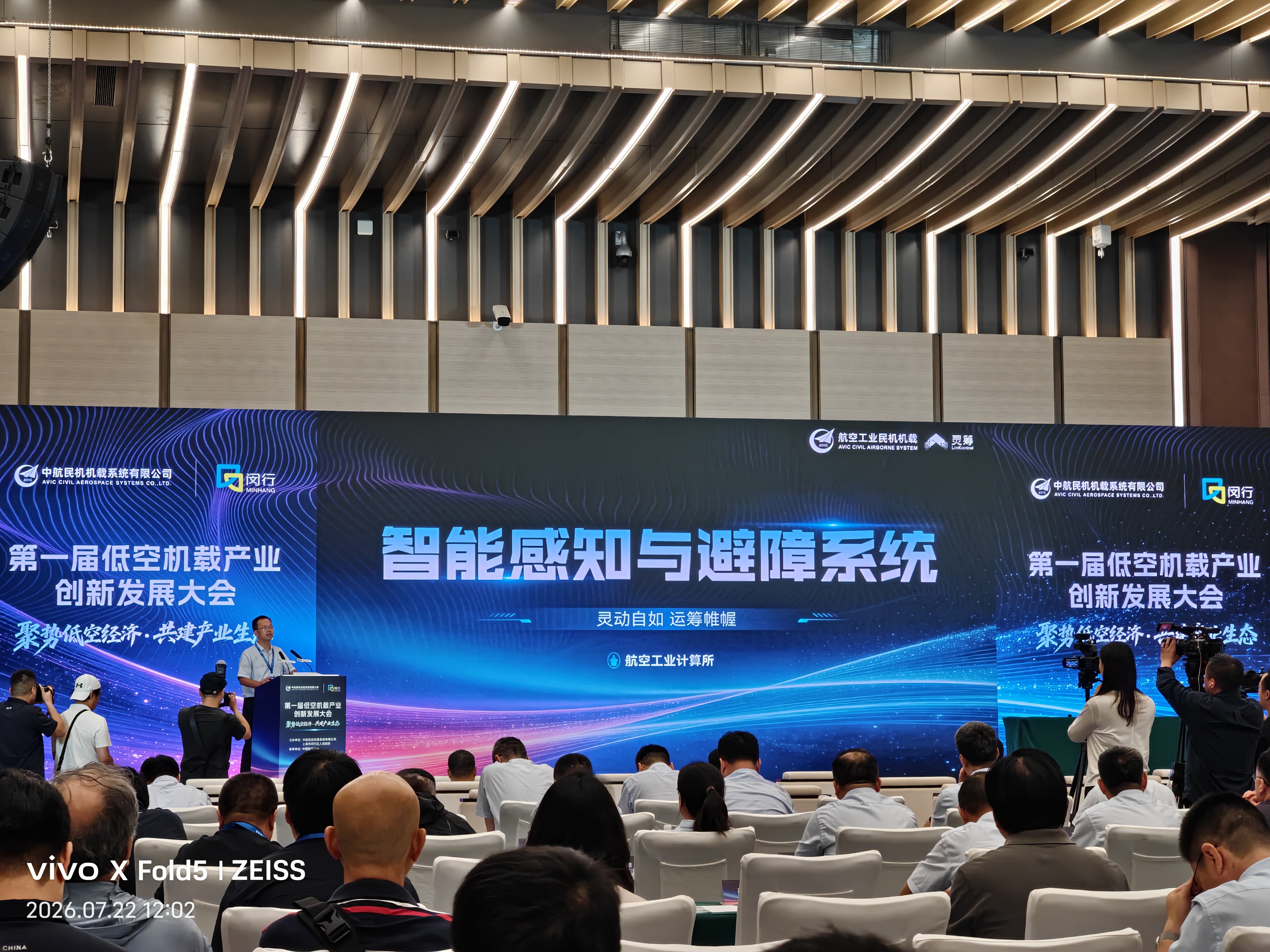
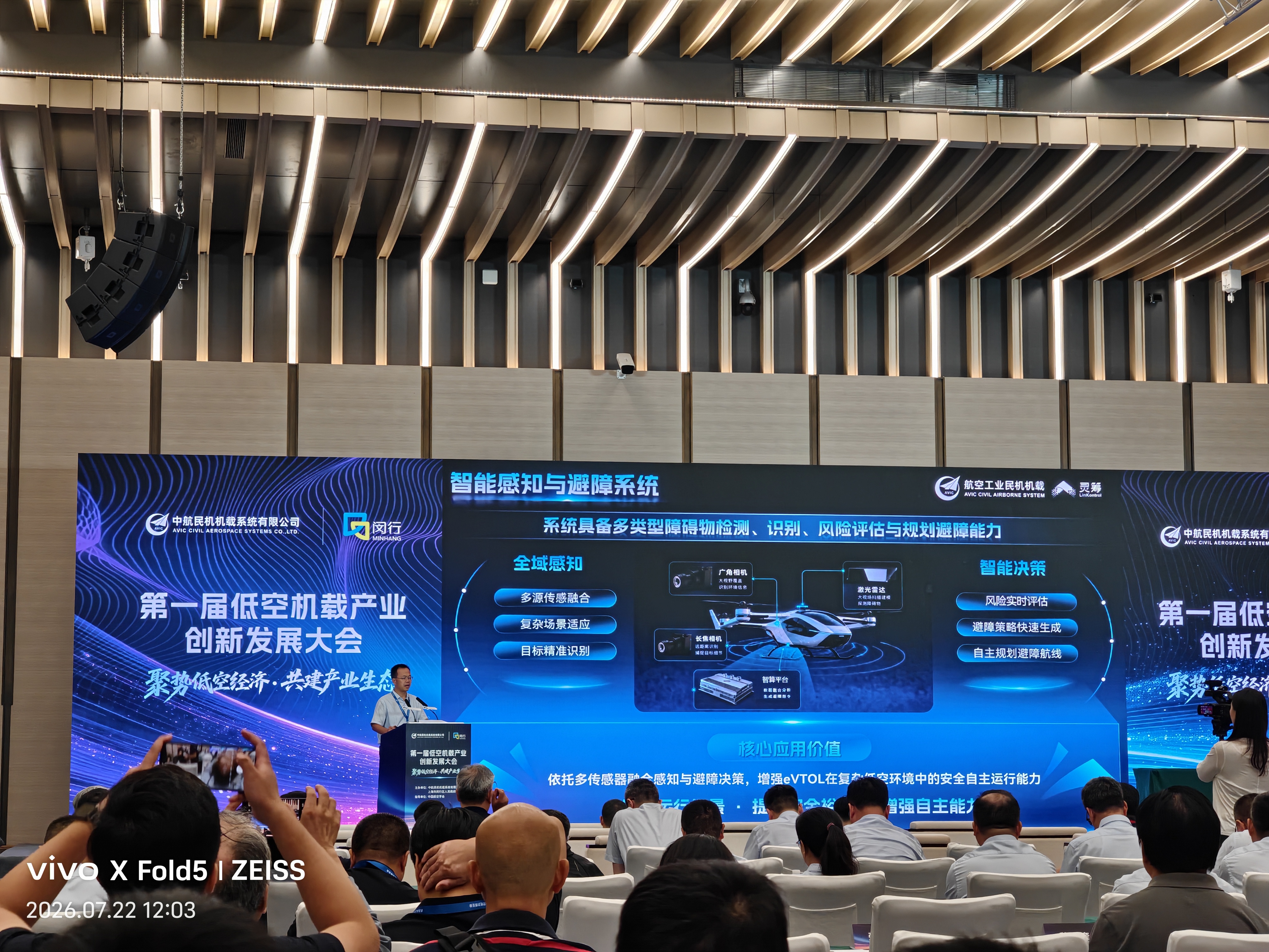
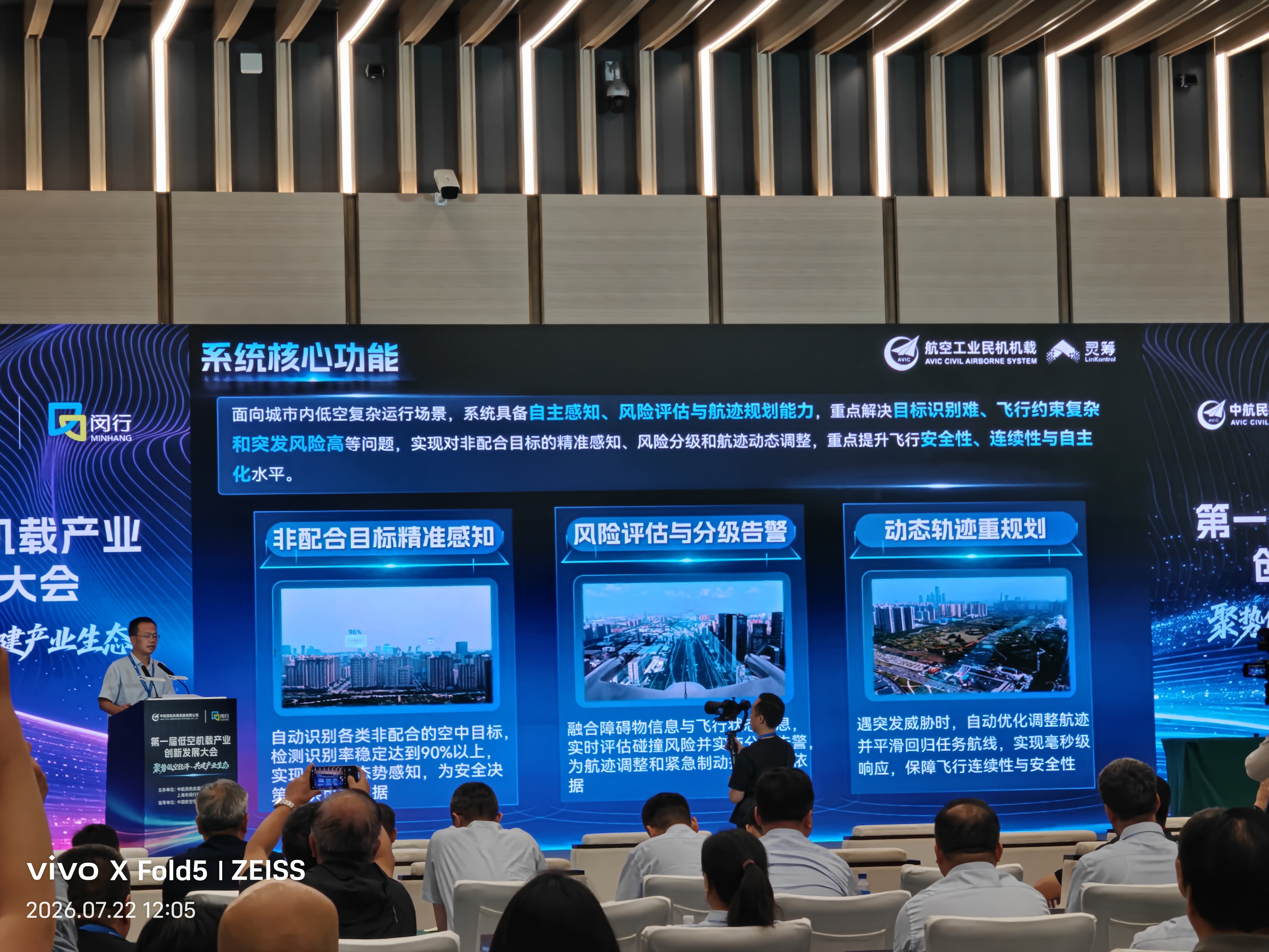
作为学生负责人,组织团队与中国航空工业西安航空计算技术研究所(631所)合作研发 DAA(Detect and Avoid,探测与避让)系统。面向城市低空复杂运行场景,融合时序同步的 4K 长焦相机、4K 广角相机与激光雷达数据,兼顾远距离目标探测与大视场覆盖;结合大小目标检测模型,实现对动态、静态障碍物及非配合空中目标的实时感知与三维定位。结合障碍物轨迹跟踪、运动预测与飞行状态信息,量化评估碰撞风险并进行分级告警,支持避障策略生成、航迹动态重规划及平滑回归任务航线,贯通感知、风险评估与决策规划。系统在第一届低空机载产业创新发展大会展示,体现多源协同感知与风险驱动避障在复杂低空场景中的应用。
Served as student project lead, coordinating joint development with AVIC Xi’an Aeronautics Computing Technique Research Institute (No. 631 Institute). The Detect and Avoid (DAA) system addresses complex urban low-altitude operations by fusing time-synchronized data from 4K telephoto and wide-angle cameras with LiDAR, combining long-range detection with broad field-of-view coverage. Detection models for large and small targets enable real-time perception and 3D localization of dynamic and static obstacles, including non-cooperative airborne targets. Combined obstacle tracking, motion prediction, and flight-state information to assess collision risk and generate graded alerts, supporting avoidance decisions, dynamic trajectory replanning, and smooth return to the mission route. The system connects perception, risk assessment, and decision-making, and was presented at the inaugural Low-Altitude Airborne Industry Innovation and Development Conference.